1 INTRODUCTION
This case study provides a brief overview of how traditional ecological knowledge (TEK) was collected and used in support of assessment and remedial activities at former legacy uranium mine sites in Saskatchewan, Canada. In particular, the case study shows that TEK can successfully be combined with scientific knowledge to bolster the development of robust site closure strategies. It also highlights appropriate TEK acquisition and management procedures.
2 PROJECT OVERVIEW
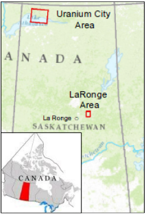
The Saskatchewan Research Council (SRC) manages the remediation of 37 legacy uranium mines and mills on public land in northern Saskatchewan, Canada (Figure 1). The objectives of the project in this case study are the mitigation of public safety risks (radiation, mine openings, hazardous substances, etc.) and addressing environmental concerns (unconfined tailings, impacted soils, acid rock drainage, etc.). The sites are located near First Nations and Métis communities. As such, SRC has been engaging with those communities to gather TEK and incorporate the information into the assessment and remediation of the sites. TEK gathering activities and how the information has been used are summarized below.

Source: SRC 2008
3 TEK COLLECTION AND MANAGEMENT
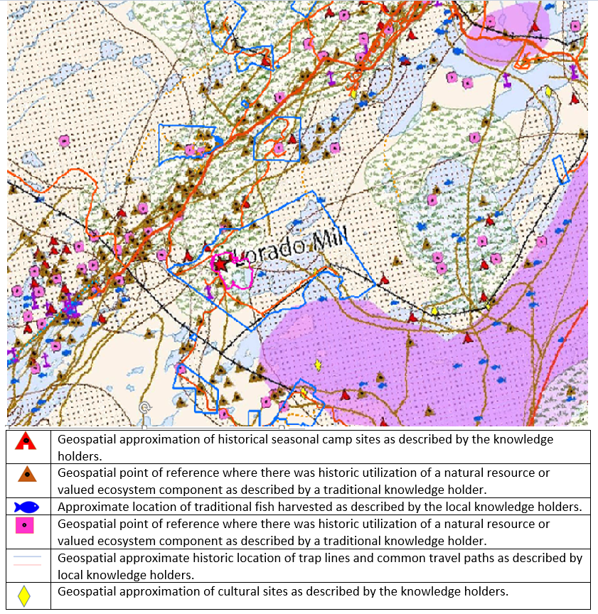
The Prince Albert Grand Council, a tribal council made up of twelve First Nations with a total of 30,000 members (PAGC 2022), conducted a study with the purpose of documenting the TEK, land use, occupancy, and vision of the Athabasca Denesuline, Métis, and local non-indigenous residents, as it relates to the remediation of the sites (PAGC 2011). This information has been integrated into SRC’s environmental data management system (EDMS). The EDMS is a geodatabase based on an SQL server and includes an entity relationship schema. Although the EDMS was not specifically set up for social or traditional knowledge data, it has been adapted to accommodate these data types. This information is used, for example, during the assessment of the sites and planning of remediation to eliminate/mitigate potential impacts of activities on culturally important locations. As presented in Figure 2, information given by knowledge holders can be amalgamated and visualized to help assessment, risk management, and remediation design. The information was freely given by the knowledge holders after their understanding of the end goal of how the data would be used. This information is available publicly upon request.

Source: SRC 2021
4 COUNTRY FOOD AND LAND USE
A country food study was carried out to develop a better understanding of the use of country foods (fish, game, and plants) by identifying the food types, amounts, and harvest locations in the Uranium City area (village in northern Saskatchewan) (CanNorth 2011 and 2012). The study gathered information from community members by means of meetings, interviews, and questionnaires. Local Indigenous project partners helped gather and translate this information (in many cases from elders whose first language was Denesuline, not English). This information is being used to evaluate exposure pathways in human health risk assessment for direct or indirect use of resources (that is, how much fish is being harvested and eaten in areas adjacent to the mine sites that have potential contaminants entering the receiving environment?).
Land use surveys were conducted in Uranium City and Fond du Lac Denesuline First Nation to gather information regarding residents’ use of the sites (SENES 2015; YNEC 2017). Members from the communities were known to visit the sites, but formal data were not available. In-person interviews were conducted using questionnaires and maps of the area and sites. The focus of the surveys was on land use in the previous 5 years and expected use in the foreseeable future to determine reasonable approximations of the time spent on the sites. Respondents were asked about visits of the sites for occupational, nonoccupational, and traditional activities such as hiking, sightseeing, hunting, fishing, trapping, snowmobiling, and harvesting firewood. These data have been used to estimate radiation exposure in risk assessment and guide remediation activities (that is, how much time do members of the local community spend on sites that have known gamma radiation levels to calculate dosimetry?). The data further support the need to address public safety concerns at the sites; for example, members indicated visiting sites that were thought to not be visited (that is, is there enough public awareness about visiting sites that have elevated radiation and the admissible dosimetry/exposure limits?).
5 CONCLUSION
Integration of TEK to the project is key to a successful remediation of the abandoned mines in a manner that considers local community members’ knowledge, use of the land, and expectations. In this case, the TEK formed the basis for developing a radiological and safety risk matrix on a site-by-site basis, provided a measure of public awareness about the risks associated with the sites, and helped guide the closure strategy for the sites based on risk and awareness.
6 REFERENCES AND ACRONYMS
The references cited in this fact sheet, and the other ITRC EDM Best Practices fact sheets, are included in one combined list that is available on the ITRC web site. The combined acronyms list is also available on the ITRC web site.


